Young Researcher Paper Award 2025
🥇Winners
🥇Winners
Print: ISSN 0914-4935
Online: ISSN 2435-0869
Sensors and Materials
is an international peer-reviewed open access journal to provide a forum for researchers working in multidisciplinary fields of sensing technology.
Online: ISSN 2435-0869
Sensors and Materials
is an international peer-reviewed open access journal to provide a forum for researchers working in multidisciplinary fields of sensing technology.
Tweets by Journal_SandM
Sensors and Materials
is covered by Science Citation Index Expanded (Clarivate Analytics), Scopus (Elsevier), and other databases.
Instructions to authors
English 日本語
Instructions for manuscript preparation
English 日本語
Template
English
Publisher
MYU K.K.
Sensors and Materials
1-23-3-303 Sendagi,
Bunkyo-ku, Tokyo 113-0022, Japan
Tel: 81-3-3827-8549
Fax: 81-3-3827-8547
MYU Research, a scientific publisher, seeks a native English-speaking proofreader with a scientific background. B.Sc. or higher degree is desirable. In-office position; work hours negotiable. Call 03-3827-8549 for further information.

MYU Research
(proofreading and recording)

MYU K.K.
(translation service)

The Art of Writing Scientific Papers
(How to write scientific papers)
(Japanese Only)
is covered by Science Citation Index Expanded (Clarivate Analytics), Scopus (Elsevier), and other databases.
Instructions to authors
English 日本語
Instructions for manuscript preparation
English 日本語
Template
English
Publisher
MYU K.K.
Sensors and Materials
1-23-3-303 Sendagi,
Bunkyo-ku, Tokyo 113-0022, Japan
Tel: 81-3-3827-8549
Fax: 81-3-3827-8547
MYU Research, a scientific publisher, seeks a native English-speaking proofreader with a scientific background. B.Sc. or higher degree is desirable. In-office position; work hours negotiable. Call 03-3827-8549 for further information.

MYU Research
(proofreading and recording)

MYU K.K.
(translation service)

The Art of Writing Scientific Papers
(How to write scientific papers)
(Japanese Only)
Sensors and Materials, Volume 32, Number 11(4) (2020)
Copyright(C) MYU K.K.
Copyright(C) MYU K.K.
|
pp. 3853-3865
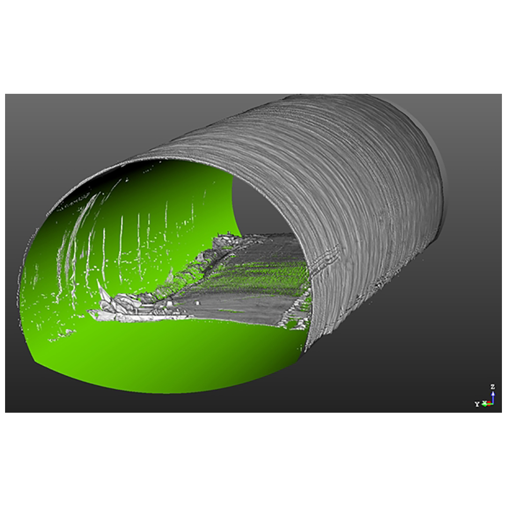
S&M2380 Research Paper of Special Issue https://doi.org/10.18494/SAM.2020.2911 Published: November 30, 2020 3D Modeling of Urban Facility Using Point Cloud Data for Realization of Smart City [PDF] Joon Kyu Park and Keun Wang Lee (Received April 26, 2020; Accepted June 19, 2020) Keywords: 3D laser scanner, accuracy analysis, point cloud, shape matching, registration
Among the structures that make up a smart city, tunnels are recognized as an important facility in the US and Canada as an infrastructure for the construction of an eco-friendly city. Total station surveying takes a long time to acquire data and has the disadvantage that the Global Navigation Satellite System (GNSS) needs to be able to receive satellites in tunnel surveying. Recently, 3D laser scanners have been attracting attention as a new technology to compensate for the disadvantages of a small amount of data and a long measurement time of the total station. Three-dimensional laser scanners can be used in various fields. In civil engineering, research and application methods often use 3D laser scanners. Because tunnel surveying is difficult in a GNSS survey due to site conditions, total station surveying has been mainly used. As total station surveying takes a lot of time to acquire data, the use of 3D laser scanners for tunnel surveying has recently been increasing. However, when using a 3D laser scanner, a large number of reference points must be installed inside the tunnel for registration and geo-referencing of acquired data. As a new technology, a shape matching method has been introduced in the field of scanning sensors, and its use is expected. In this study, a tunnel survey using a 3D laser scanner was performed and its utility was evaluated. Also, the accuracy of the shape registration method for recent registration was analyzed. The scanning data were acquired by configuring a traverse using the total station function and compared with 10 checkpoints already installed for accuracy verification. As a result of the accuracy evaluation by comparison with the checkpoints, the maximum error was within 6 cm in the N, E, and H directions, and these results indicate the plane and elevation allowable accuracy of a 1:1000 digital map, suggesting the applicability of the method using the reference point performance and the laser scanning data. By using scan data, not only analysis of the cross section but also continuous analysis of the shape of the scanning section is possible. An additional evaluation of the accuracy of shape matching of the 3D laser scanner data was performed. By using the scanning data acquired five times, geo-referencing of the data acquired at the first station was performed, and then the data obtained were registered by the shape matching method. A maximum of error of 1 m occurred at the end of the data. This indicates that the accuracy of the shape registration can be degraded if the same shape is repeated, such as in a tunnel. Therefore, in tunnel surveying, it is judged that the construction of the data only by shape matching may lower the accuracy. Further research can improve the accuracy of the shape registration method, which will improve the efficiency of tunnel surveying.
Corresponding author: Keun Wang Lee  This work is licensed under a Creative Commons Attribution 4.0 International License. Cite this article Joon Kyu Park and Keun Wang Lee, 3D Modeling of Urban Facility Using Point Cloud Data for Realization of Smart City, Sens. Mater., Vol. 32, No. 11, 2020, p. 3853-3865. |
Forthcoming Regular Issues
Forthcoming Special Issues
Special Issue on Novel Sensors, Materials, and Related Technologies on Artificial Intelligence of Things Applications
Guest editor, Teen-Hang Meen (National Formosa University), Wenbing Zhao (Cleveland State University), and Cheng-Fu Yang (National University of Kaohsiung)
Call for paper
Special Issue on Unique Physical Behavior at the Nano to Atomic Scales
Guest editor, Takahiro Namazu (Kyoto University of Advanced Science)
Call for paper
Special Issue on Support Systems for Human Environment Utilizing Sensor Technology and Image Processing Including AI
Guest editor, Takashi Oyabu (Nihonkai International Exchange Center)
Call for paper
Special Issue on Mobile Computing and Ubiquitous Networking for Smart Society
Guest editor, Akira Uchiyama (The University of Osaka) and Jaehoon Paul Jeong (Sungkyunkwan University)
Call for paper
Special Issue on Advanced Materials and Technologies for Sensor and Artificial- Intelligence-of-Things Applications (Selected Papers from ICASI 2026)
Guest editor, Sheng-Joue Young (National United University)
Conference website
Call for paper
Special Issue on Innovations in Multimodal Sensing for Intelligent Devices, Systems, and Applications
Guest editor, Jiahui Yu (Research scientist, Zhejiang University), Kairu Li (Professor, Shenyang University of Technology), Yinfeng Fang (Professor, Hangzhou Dianzi University), Chin Wei Hong (Professor, Tokyo Metropolitan University), Zhiqiang Zhang (Professor, University of Leeds)
Call for paper
-
For more information of Special Issues (click here)
-
Special Issue on Advanced Materials and Technologies for Sensor and Artificial- Intelligence-of-Things Applications (Selected Papers from ICASI 2025)
- Accepted papers (click here)
- High-precision Autonomous Driving Map Quality Inspection Indicator System and Evaluation Method
Chengcheng Li, Ming Dong, Hongli Li, Xunwen Yu, Yongxuan Liu, and Chong Zhang
- High-precision Autonomous Driving Map Quality Inspection Indicator System and Evaluation Method
- Accepted papers (click here)
- Scalable Real-time Energy Monitoring, Analysis, and Optimization in Five-axis Machine Tools: An Industrial Internet of Energy-based Approach
Swami Nath Maurya, Kun-Ying Li, Windu Aditya Nur Faeza, and Yue-Feng Lin
- Scalable Real-time Energy Monitoring, Analysis, and Optimization in Five-axis Machine Tools: An Industrial Internet of Energy-based Approach
Guest editor, Sheng-Joue Young (National United University)
Conference website
Call for paper
Special Issue on Multisource Sensors for Geographic Spatiotemporal Analysis and Social Sensing Technology Part 5
Guest editor, Prof. Bogang Yang (Beijing Institute of Surveying and Mapping) and Prof. Xiang Lei Liu (Beijing University of Civil Engineering and Architecture)
Special Issue on Advanced GeoAI for Smart Cities: Novel Data Modeling with Multi-source Sensor Data
Guest editor, Prof. Changfeng Jing (China University of Geosciences Beijing)
Call for paper
Special Issue on Materials, Devices, Circuits, and Analytical Methods for Various Sensors (Selected Papers from ICSEVEN 2025)
Guest editor, Chien-Jung Huang (National University of Kaohsiung), Mu-Chun Wang (Minghsin University of Science and Technology), Shih-Hung Lin (Chung Shan Medical University), Ja-Hao Chen (Feng Chia University)
Conference website
Call for paper
Special Issue on Sensing and Data Analysis Technologies for Living Environment, Health Care, Production Management, and Engineering/Science Education Applications (2025)
Guest editor, Chien-Jung Huang (National University of Kaohsiung), Rey-Chue Hwang (I-Shou University), Ja-Hao Chen (Feng Chia University), Ba-Son Nguyen (Lac Hong University)
Call for paper
Special Issue on Advances in Sensors and Computational Intelligence for Industrial Applications
Guest editor, Chih-Hsien Hsia (National Ilan University)
Call for paper
Special Issue on AI-driven Sustainable Sensor Materials, Processes, and Circular Economy Applications
Guest editor, Shih-Chen Shi (National Cheng Kung University) and Tao-Hsing Chen (National Kaohsiung University of Science and Technology)
Call for paper
- Accepted papers (click here)
Copyright(C) MYU K.K. All Rights Reserved.
